Issue Briefs
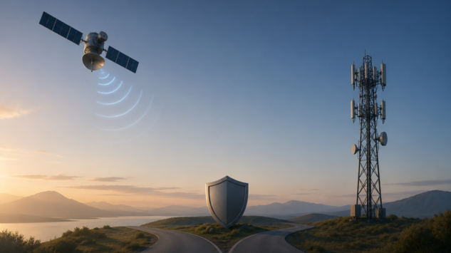
Spectrum Wars: Why There Is No National Security Case for Opening the Lower 900 MHz Band for a GPS Backup
By Rebecca L. Grant, Ph.D., Vice President, Lexington Institute.
July 7, 2026
Spectrum is a major responsibility for the Federal Communications Commission, which is why the FCC is in the midst of internal deliberations about whether to open spectrum blocks to help with GPS resilience.
The backstory is as follows. In 2025, the FCC set out to explore alternatives to GPS, the satellite global positioning system run by the United States Space Force and used by Americans every day. FCC Chairman Brendan Carr told a harrowing story of the intense solar flares that briefly disrupted GPS receivers and stranded tractors back in May 2024. The FCC inquiry aimed to “explore other Precision Navigation and Timing (PNT) systems that can be complements or alternatives to GPS, with an emphasis on complementary systems.”
However, a vigorous discussion on opening spectrum for a terrestrial backup to GPS has opened a can of worms. Advocates say a terrestrial system can enhance public safety and national security by providing a backup in a GPS-denied environment. The problem is interference: the 900 MHz band is where numerous small, low-power devices operate, such as an estimated 160 million smart meters. Opening up the 900 MHz to high-power broadband could swamp eight categories of devices critical to electric grids.
The House of Representatives weighed in with a hearing on terrestrial and other alternative systems. “We are working to develop a secondary GPS system,” commented Rep. Kat Cammack. “That is critically important, but we’ve got to do it in a smart way so we don’t create a whole new host of problems,” she said in a June 4 video.
Leave aside, for a moment, the valid and serious objections raised by over 60 companies and trade associations. The argument that the lower 900 MHz band needs to take center stage as a GPS backup for national security reasons just does not hold up.
GPS resilience is a real concern. However, it is important to recognize that the owners and operators of the GPS constellation are all over this issue. That would be, of course, the U.S. Space Force.
The Global Positioning System actually began as a United States Air Force project. Emerging from a 1960s concept for “lighthouses in the sky,” early satellites helped nuclear submarines track their positions. The first Navstar GPS satellites were launched in the 1970s and 1980s. Airlines accessed GPS in 1983, while handheld GPS receivers appeared by 1989. In 1991, Operation Desert Storm made use of the signal in its six-week air campaign. The complete constellation of satellites became fully operational in 1995. GPS first appeared in a cellphone in 1999, and in 2000, the government removed restrictions on GPS signals, boosting their strength by a factor of 10. Today, the GPS system is operated by the United States Space Force from Schriever Space Force Base in Colorado.
“GPS was free from interference when it was first developed in the latter part of the 20th century, but today it needs protection,” noted a recent Heritage Foundation study. From the start, the GPS user community has realized that the relatively low-power signals can be jammed or disrupted. First the Air Force, and now the Space Force, have been coping with threats to GPS for decades.
The Space Force takes GPS seriously. “By combining new tactics, rapid upgrades and testing-in-ops, we boosted the average global GPS accuracy by 40%,” Chief of Space Force General Chance B. Saltzman said last year. Launch times for new GPS satellites have dropped from two years to a mere three months.
U.S. Space Force opened the Operation Epic Fury campaign by blasting Iran with electromagnetic effects from space, all while operating the GPS constellation for precision targeting.
This is a real-world, right now problem set. USSF has a number of GPS upgrades underway. Space Force just bought two more GPS satellites, and on May 26, USSF awarded a $2.29 billion contract to SpaceX for StarShield, an on-orbit net of LEO satellites enabled by optical communications links that will be robust enough to carry targeting data. This Space Data Network Backbone “ensures our sensors are connected continuously, globally, and securely to deliver world-wide tactical communications and broadband communication services,” Space Systems Command posted on May 27.
Don’t forget Golden Dome. The missile defense shield will rely on resilient PNT for sensors, interceptors, and command and control.
On-orbit commercial systems also offer alternative PNT. Some, like Iridium, use higher orbits. However, the major transition comes with PNT on low Earth orbit satellites. GPS satellites in MEO transmit in L-band. Starlink satellites in low Earth orbit with the Ku-band create a power advantage. New entrants like Amazon LEO will offer additional competitive options as they build out their constellations.
Oddball terrestrial proposals can’t claim much of a national security case.
This article was originally published on the Lexington Institute: Spectrum Wars: Why There Is No National Security Case for Opening the Lower 900 MHz Band for a GPS Backup | Lexington Institute
Legal Disclaimer
The Global Policy Institute (GPI) publishes this content on an “as-is” basis, without any express or implied warranties of any kind. GPI explicitly disclaims any responsibility or liability for the accuracy, completeness, legality, or reliability of the information, images, videos, or sources referenced in this article. The views expressed are those of the author and do not necessarily reflect the opinions or positions of GPI. Any concerns, copyright issues, or complaints regarding this content should be directed to the author.